Physical Oceanography, Limnology & Acoustics


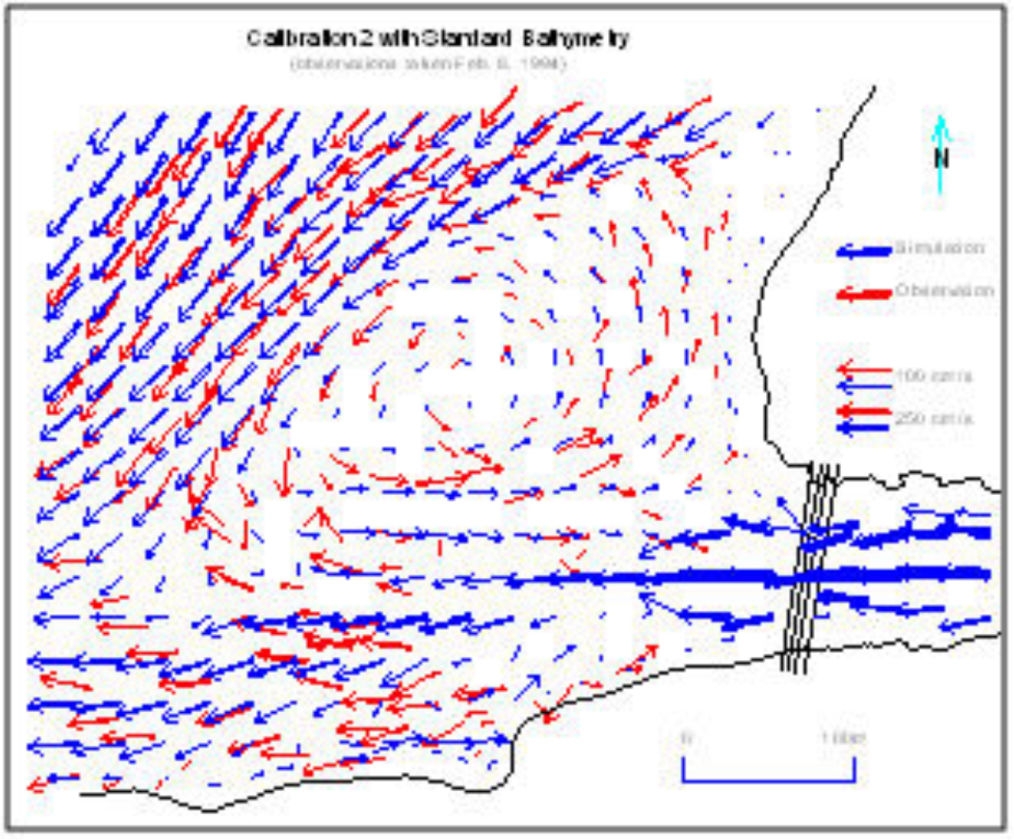
Time lapse video showing spatial current distribution in a fjord-like inlet based on multiple along-inlet current meter moorings. Such displays better show the effect of forcing mechanisms such as wind, tide and stratification.

Physical Oceanography


ASL’s staff of oceanographers, scientists and engineers are specialists in all aspects of physical oceanography and limnology, including currents/waves/tides, water quality (temperature, salinity, turbidity, chlorophyl, DO), sediment transport/turbidity flows, ice, and underwater acoustics. We draw upon in-house experts in numerical modelling and remote sensing as required to meet our clients’ needs.

With our engineering group we are able to manufacture custom mooring frames and cages specific to our clients’ projects. Our field services group has over 50 years total experience and over the past 10 years we have a mooring recovery rate of 99%. Some data collection moorings are deployed locally for a few days while others may be for nine months under the ice in the Arctic where they are all but inaccessible except for a few months in the summer. Other systems are real-time with data available on demand. 

We have always used the latest technology. When ASL started 40 years ago the current meters were Aanderaa RCM4’s with paddle wheel rotors for speed and vanes for direction. Now we own over 50 state-of-the art Acoustic Doppler Current profilers (ADCPs). Laboratory analyses for water properties have been largely replaced by in-situ sensors such as CTDs and optical sensors for turbidity, chlorophyl and dissolved oxygen. We recently purchased four in-situ underwater noise recorders for measurement of noise from vessels, mammals, gas pipelines, etc. We manufacture our own AZFP, a multi-frequency echosounder for measuring distribution of plankton and fish. 

Whatever your needs, we have either done it or can do it. Give us a call. Following are some examples of the types of projects we have done, and the industries we work with. 

file:///D:/Websites/ASL_WEBSITES/assets/images/871-2014-s-500x332.jpg

Metocean for Oil and Gas 


ASL has conducted offshore metocean studies for our oil and gas clients worldwide, including such remote and challenging areas as Columbia, Equatorial Guinea, Russia (Sakhalin and Pechora Sea), the Beaufort Sea and offshore Alaska, and Kazakhstan’s Caspian Sea.

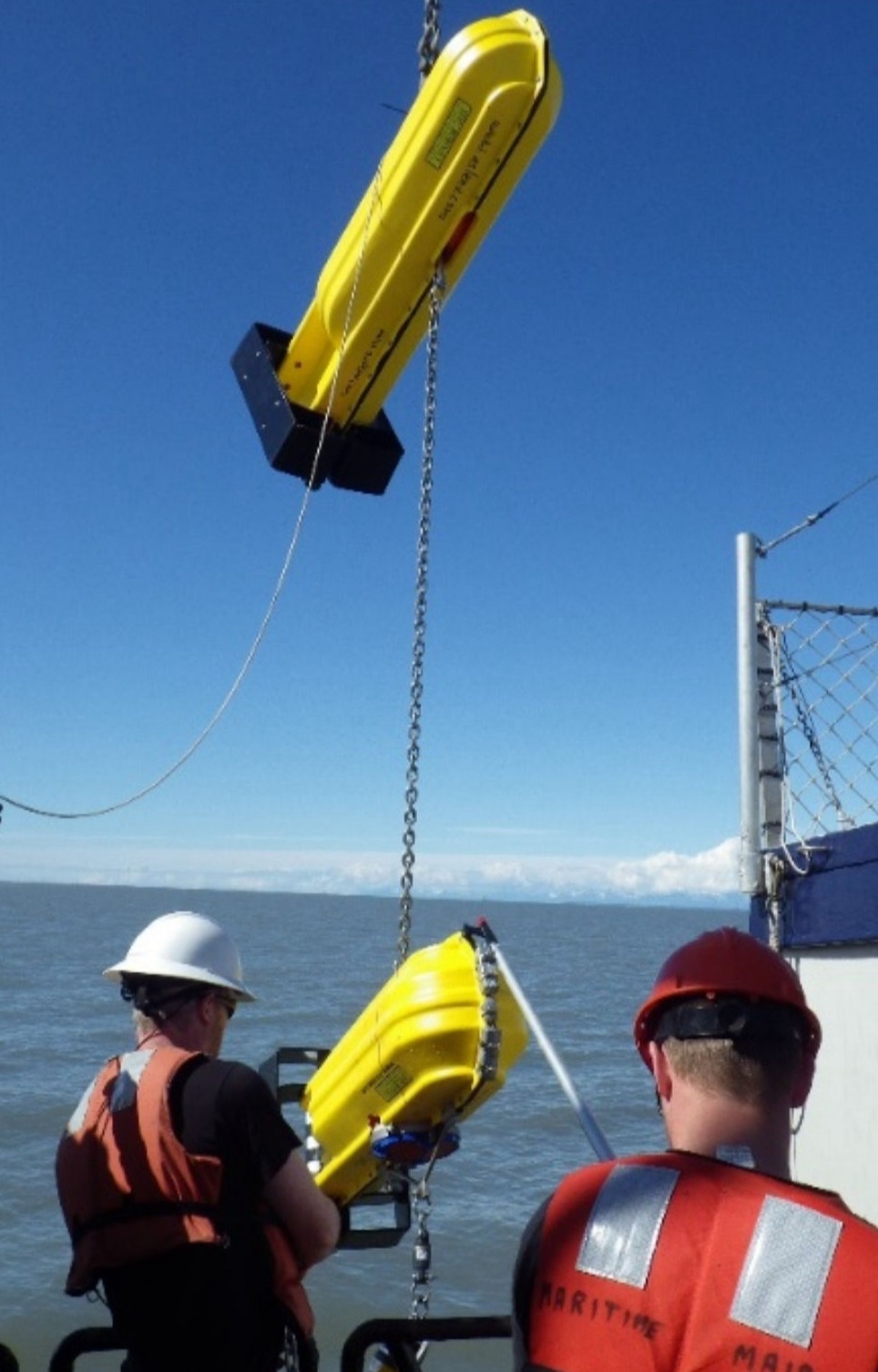
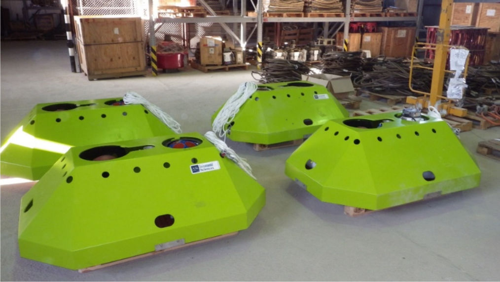
As an example, from 2013–2016 ASL deployed multiple metocean moorings in Cook Inlet for an LNG terminal study, with service trips every six months. Measurements included ice draft, currents, water level, waves and water properties. Hazards included strong currents (4–5 knots), underwater debris, and ice. Due to the strong currents, debris, and risk of ice impact, specially designed bottom frames were used to house the underwater instrumentation. Mooring recovery rate was 100%.   


The Aquaculture Industry

The aquaculture industry, particularly fish farms, require accurate current and wave data for both site selection and pen/anchor design. Requirements have evolved and now full water column currents over several months are becoming the norm. In many cases CTD and DO profiles are also collected.

More recently the government is taking a wide-area ecosystem management approach. ASL assists our clients with these new demands, often employing high resolution numerical modelling such as the FVCOM model. 


Mud Study

Near-bottom Current Measurements for Cable and Pipeline Projects, Turbidity Flows and Dredged Disposal Sites.


Engineers involved in marine cable and pipeline design work require current data within 1 meter of bottom, as do scientists and engineers involved in dredged disposal studies. Researchers studying turbidity flows need similar data. ASL has developed techniques for measuring the near-bottom currents, and the turbidity or suspended sediment concentration. High resolution ADCP profiles capture the bottom layer velocity profile and near bottom turbidity.  ASL also provides a multi-frequency echosounder “MUD” for measuring suspended sediment and bedload resulting from turbidity flows. 

Mud Study

current-rose

Oceanographic Support for Ports and Harbours 

In the design phase ASL can acquire current and wave data at the berth to assist the engineers with berth and terminal design. Hindcast modelling can be used to provide extreme values.

For port operation ASL can set up and operate real-time systems. An example is the current station at Second Narrows in Vancouver. Vessel traffic can access the current speed and water level in real-time via the AIS system. ASL monitors the data 24-7 and can switch to the backup system if needed. ASL also deals with routine maintenance of the two systems of H-ADCPs.  


file:///D:/Websites/ASL_WEBSITES/assets/images/871-2014-s-500x332.jpg

Marine Renewable Energy


Development of marine renewable energy requires oceanographic input for the engineering design and site selection. ASL assists clients by offering current and wave data collection, extremal analyses, and numerical modelling. We can also assess the potential for sediment scour and monitor changes.

An example is ASL’s support of the tidal energy industry. Since 2006 ASL has assisted clients with site selection through current surveys that pinpoint the location with optimal flow.
ASL also assisted with one of the first offshore wind energy studies in Hecate Strait. Current and wave data collected by ASL highlighted the extreme oceanographic conditions there.


Limnology, Rivers and Inland Seas


As well as oceans and coastal waters, ASL assists clients with limnological freshwater systems, including rivers, streams, lakes and reservoirs. In most cases, currents and water properties are highly important. ASL can help with understanding complex water quality issues such as eutrophication and has a pool of water quality loggers such as dissolved oxygen, chlorophyll and turbidity. We have other tools as well such as numerical modelling and remote sensing.

file:///D:/Websites/ASL_WEBSITES/assets/images/871-2014-s-500x332.jpg

Hydroelectric Dams 


ASL has assisted many of our hydroelectric clients with flow surveys both upstream in the reservoir, as well as downstream. The current data is often used to validate numerical models. For example we have used models to predict what effect, if any, changes to a dam might have on the downstream flow.
ASL also offers an Acoustic Scintillation Flow Meter for measurement of the flow in to the turbines. It offers advantages over other methods in that it does not require a long section of pipe, but fits into the slot just above the intake


file:///D:/Websites/ASL_WEBSITES/assets/images/871-2014-s-500x332.jpg

Inland Seas and Oil and Gas

Inland seas such as the Caspian are unusual in that they are cut off from the ocean. Waters are either fresh or brackish but, especially the larger seas, experience the same wind and wave forces and even tides. ASL assists clients, such as oil and gas operators, with physical oceanographic studies, metocean data collection, analyses and reports. Seas in higher latitudes may be ice covered parts of the year and ASL can provide ice draft data using the IPS4 ice profiler. ASL also offers route analyses based on bathymetry and historical ice data.


file:///D:/Websites/ASL_WEBSITES/assets/images/871-2014-s-500x332.jpg

Large Rivers


Large rivers can offer special challenges particularly during freshet when strong currents and debris pose serious risks to any operations. ASL has years of experience operating on large rivers, including the Fraser, Mackenzie, and the Saint Lawrence, We can obtain current transect data, deploy current meters on moorings, and track drogues for Lagrangian current data. Water properties such as temperature, salinity and turbidity are often measured as well. Numerical models can be useful for predicting “what if” scenarios such as what happens to the flow if we build a terminal with a dock.


file:///D:/Websites/ASL_WEBSITES/assets/images/871-2014-s-500x332.jpg

Discharge Measurements


The volume or discharge from rivers and streams is important for fisheries, irrigation, and other planning such as flood control. ASL owns and operates several flow/discharge measurement systems including the TRDI StreamPro and RiverRay ADCPs. Some sites require point measurements with propeller or EM sensors.
The ASL field group have helped with client studies by measuring discharge on many rivers and streams including the Fraser, Columbia, Ottawa, and the Squamish.


file:///D:/Websites/ASL_WEBSITES/assets/images/871-2014-s-500x332.jpg

Mine Development


Mine development and operation often affect nearby lakes and rivers. ASL can assist with flow and water quality measurements. We also offer numerical modelling for predicting discharge dispersion. Our remote sensing group has extensive experience in mapping remedial projects such as land reclamation.

In Canada the mines are often at higher latitudes and elevation and the water bodies may be ice covered in winter. Equipment is often deployed through the ice necessitating the cutting of large holes. This can be laborious since freshwater ice is much harder than sea ice.


Acoustics


Marine acoustics involves either passive measurements (for instance measurements of ambient noise, marine mammals, or vessel traffic) or active measurements of backscatter from targets such as ice, plankton, or fish.  

file:///D:/Websites/ASL_WEBSITES/assets/images/871-2014-s-500x332.jpg

Passive Noise Recorders 

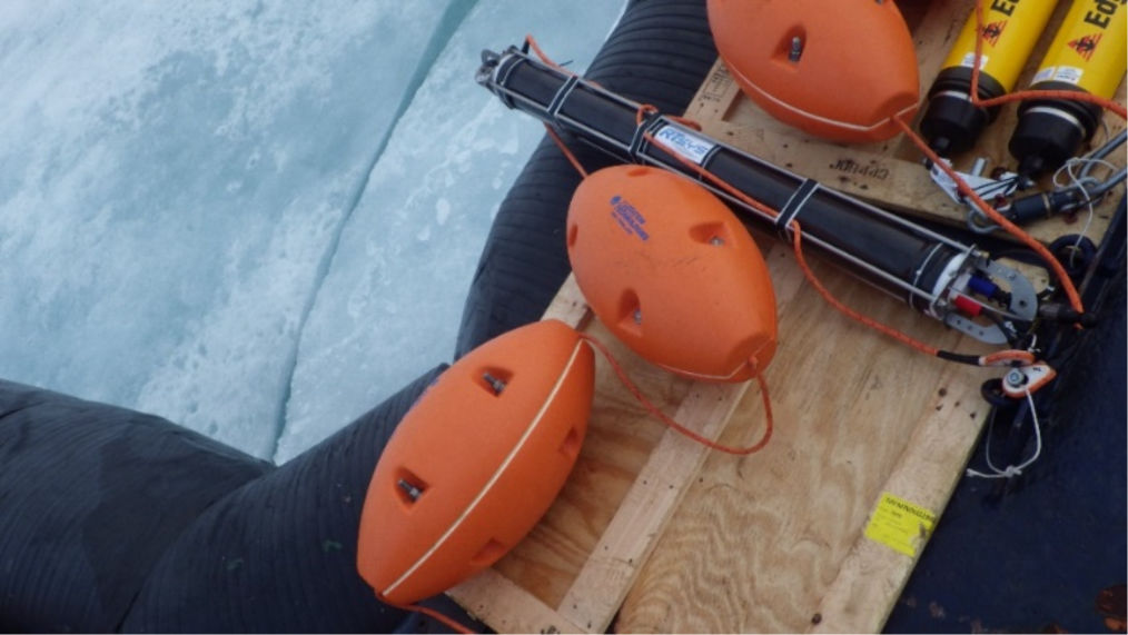
ASL uses passive noise recorders to measure ambient/background noise, as well as man-made noise such as from vessel traffic, dredging activity, and even the noise generated by the flow of gas in pipelines. We own several noise recorders (RTSys & Turbulent Research) which can be used in real-time, and can also be deployed on moorings for extended periods of time.


Active Sonar


Active sonar projects include bio-acoustic surveys of fish and plankton. ASL uses Acoustic Zooplankton Fish Profilers (AZFP) to study the time varying distributions of plankton and fish. The multi-frequency AZFP can differentiate between different types of plankton and fish. It can be used real-time mounted alongside a boat or deployed for periods up to several months in-situ using internal memory and battery. Example studies include the following:

Months long acoustic profiles from moored sonars (AZFP) to study timing and distribution of eulachon fish migrating through the Salish Sea to enter the Fraser River to spawn.

During the multi-year MARES program the AZFP was installed on long-term metocean moorings in the Beaufort Sea to help gather data on the presence and abundance of zooplankton and fish (adult and larval Arctic cod).

Use of multi-frequency sonar (AZFP) to better understand the relationship between Arctic cod and copepod zooplankton in the Canadian Arctic. (Dr Niemi, DFO)

Use of a modified multi-frequency echosounder (AZFP) for quantitative spatial sampling of baleen whale prey in British Columbia. (Rhonda Ready, University of Victoria)

Multi-year study of relationships between dissolved oxygen, nutrients and cyanobacteria blooms in an eutrophic lake (with Diversified Scientific Solutions, Swan Lake, BC). The AZFP was used to map time and spatial variations in the plankton distribution.

ASL also has a long history in the measurement of ice draft, both sea ice and freshwater. The measurements are made using a single frequency, narrow beam, echosounder called an Ice Profiling Sonar. The IPS is powered by a large capacity alkaline battery and has internal memory allowing it to be deployed for up to a year.

The ice profiling sonars are also used to measure frazil ice which can lead to the formation of anchor ice which can cause problems with equipment.


ASL Environmental Sciences #1-6703 Rajpur Place V8M 1Z5 Saanichton, BC
Canada

Phone: +1 250-656-0177
Email: asl@aslenv.com
Website:www.aslenv.com