Ocean Data Geoportal
Technical paper: Design and Development of a Greenland Ice and Metocean Geoportal (ATC 2015)
A web-based marine geoportal from which your ice, meteorological, oceanographic, and seabed data can be integrated and accessed.
The geoportal is a collaborative tool that allows multiple users to interact with the system.
Web based marine geo-portal data can include:
- sea ice
- icebergs
- oceanography: currents, waves, water quality, etc
- meteorology: winds, air temperature, humidity, visibility, etc
- seabed: bathymetry, ice scouring, sediment
Key Features
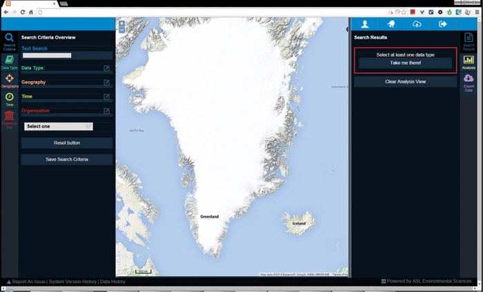
Search:
Other Features
Sophisticated and intuitive search engine for simple to complex queries including geo-spatial, temporal, and other criteria.
Visualization:
Interactive map and text summaries of results allowing you to readily explore data and metadata.
Analysis:
Built in tools for statistical analysis of user selected data sets.
Export:
Download any data in GIS compatible format.Secure:
Track data as it moves through data management process:
User login/logout Customizable dataset permissions
Customizable:
Save search criteria and results for future use
Stable:
Automatically restores last session
Responsive:
Search results automatically and immediately displayed as user defines search query
Why ASL?
- Standardization of received data and metadata.
- Database integration
Quality control throughout
- decades of experience carrying out oceanographic, ice and meteorological projects
- cutting-edge software engineering team
- familiarity with the end user - scientists, engineers and operational planners