
Hyperspectral mapping of biofilm.
As part of an environmental assessment for Port of Metro Vancouver (PMV), ASL was commissioned for the processing and analysis of hyperspectral data in the Roberts Bank intertidal zone.
ASL produced maps of biofilm in Roberts Bank, including biomass estimation of the microphytobenthos (i.e., the chlorophyll-containing component of the biofilm). Secondary maps were produced of other habitat classes such as eelgrass, biomat and other vegetation.
Project services included:
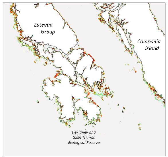
Kelp bed mapping.
The channel from Hecate Strait, through Douglas Channel to the city of Kitimat, has been identified as a strategic gateway for the oil and gas industry. To support circulation models and oil spill contingency planning by Fisheries & Oceans Canada, ASL created seasonal maps of kelp beds in eastern Hecate Strait.
Project services included:

Classification of Intertidal vegetation.
Prior to the port expansion at Prince Rupert, BC, Borstad Associates conducted an airborne survey to map sensitive marine habitat in the areas surrounding Kaien Island, Digby Island, Ridley Island and the Tsimpsean Peninsula. This included extensive eelgrass beds south of Ridley Island and kelp beds west of Digby Island.
Project services included:

Sediment classification (left) and bathymetry (right) maps.
Under contract to the Government of Mauritius, Borstad Associates acquired multispectral airborne imagery of the lagoon systems of Mauritius and Rodrigues, from shore to fringing reef. This imagery was used to create an atlas of thematic maps as well as bathymetric maps for the entire lagoon systems of Mauritius and Rodrigues, for use in coastal management.
Project services included:
Contact
For more information about our remote sensing capabilities, click here
ASL Environmental Sciences #1-6703 Rajpur Place V8M 1Z5 Saanichton, BC
Canada
Phone: +1 250-656-0177
Email: asl@aslenv.com
Website:www.aslenv.com
