
Aerial Survey using a Saltspring Air de Havilland Beaver.

2013 vegetation assessment.
Highland Valley Copper (HVC) near Kamloops, British Columbia has had a major mine reclamation program underway since 1983, in which the establishment and development of self-sustaining vegetative cover are important elements.
Airborne multispectral surveys to supplement the ground surveys were initiated by Borstad Associates in 2001 and were repeated annually until 2011, when high resolution satellite imagery became a feasible alternative. These remote sensing surveys provided synoptic, quantitative thematic maps of the vegetation on the mine site and were used to extrapolate from and between the more detailed observations at ground sampling sites.
Services provided included:
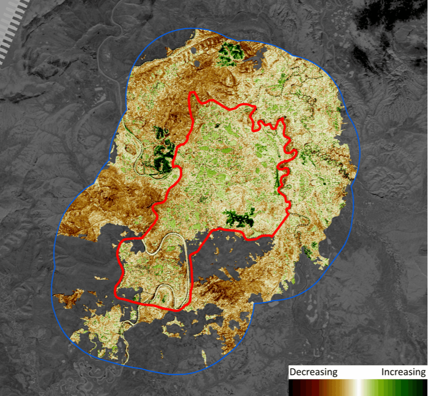
1985-2009 trend in vegetation greenness.
The Whitefish Wetlands is a 467 km2 proposed Habitat Protection Area in north-central Yukon. In 2015 ASL was contracted by Environment Yukon to establish a baseline of vegetation information and to assess change in the study area.
Using Landsat 5 data from 2009, we created an 8-class land cover map that included four classes of wetland or aquatic vegetation and three classes of upland vegetation. Landsat 5 and 7 data were then used to construct a time-series of imagery back to 1985. From this time-series, long-term trend information was extracted.
Services provided included:

1985-2010 change in glacier extent at Franklin Arm.
As part of the Canadian Space Agency funded LakeView project, the extent of glaciers in the Chilko Lake watershed was assessed from a 1985-2010 time series of Landsat images. Over the 25 years, decreases between 0.24% and 0.47% were observed for glaciers in the eastern and western slopes of the lake’s south arm and in Franklin Arm.
Project services included:
Learn more about LakeView project
Contact
For more information about our remote sensing capabilities, click here
ASL Environmental Sciences #1-6703 Rajpur Place V8M 1Z5 Saanichton, BC
Canada
Phone: +1 250-656-0177
Email: asl@aslenv.com
Website:www.aslenv.com
